Overview
Background
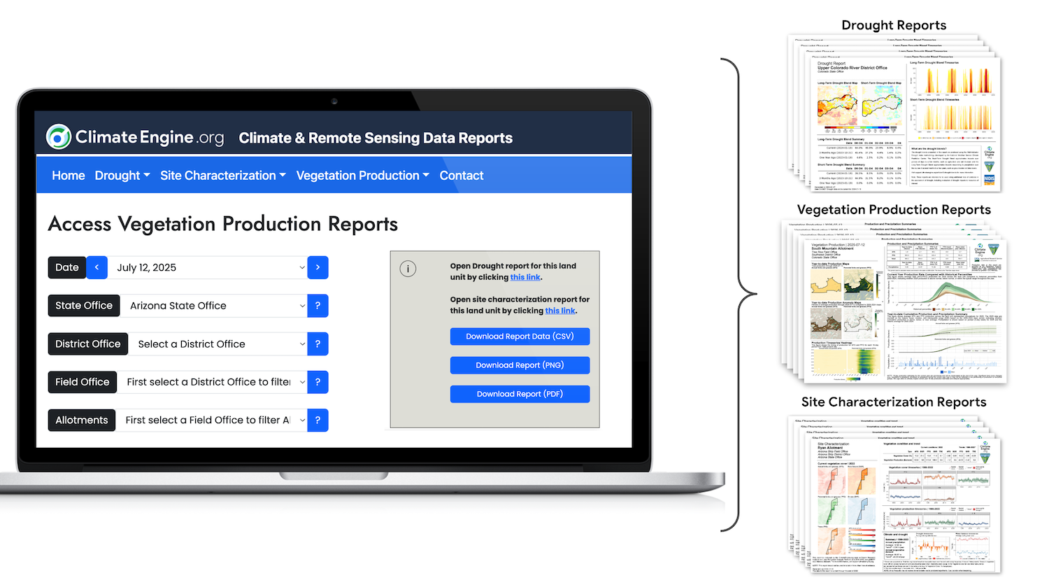
Climate Engine Reports is a dedicated platform designed to serve the needs of resource management agency staff and partners by providing reliable and consistent summaries of drought conditions and vegetation status and trend. To explore reports, visit the reporting website.
One of the website's objectives is to make large climate and satellite-based vegetation datasets more accessible by providing downloadable PNG and PDF reports to support adaptive management and decision making. It is essential to emphasize that these reports should not be viewed in isolation. They should be considered alongside other sources of information to ensure a comprehensive assessment of factors such as drought severity and impacts, vegetation condition and trends, and related processes.
The ClimateEngine.org Reports website is the outcome of a collaborative initiative, jointly led by the Desert Research Institute and the University of California-Merced, in conjunction with the Bureau of Land Management. Additionally, NOAA's National Integrated Drought Information System (NIDIS) has been integral in the development of ClimateEngine.org and the drought metrics provided through the reports and USDA-ARS USDA-ARS has supported development by providing Rangeland Analysis Platform data and guiding the design of the Vegetation Production reports. Our shared aim is to provide reliable and consistent information for supporting decision-making in the realm of resource management and conservation.
Report Types
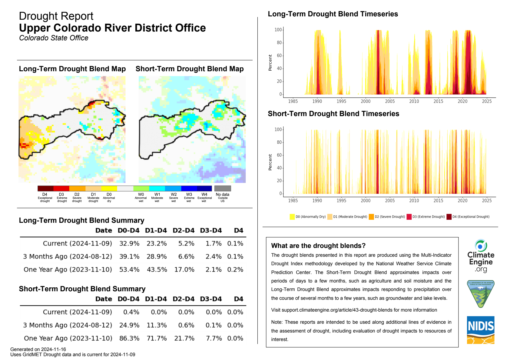
The Drought Reports provide maps, tables, and timeseries of multi-indicator drought indices (long-term and short-term drought) and underlying data pulled from gridMET Drought.
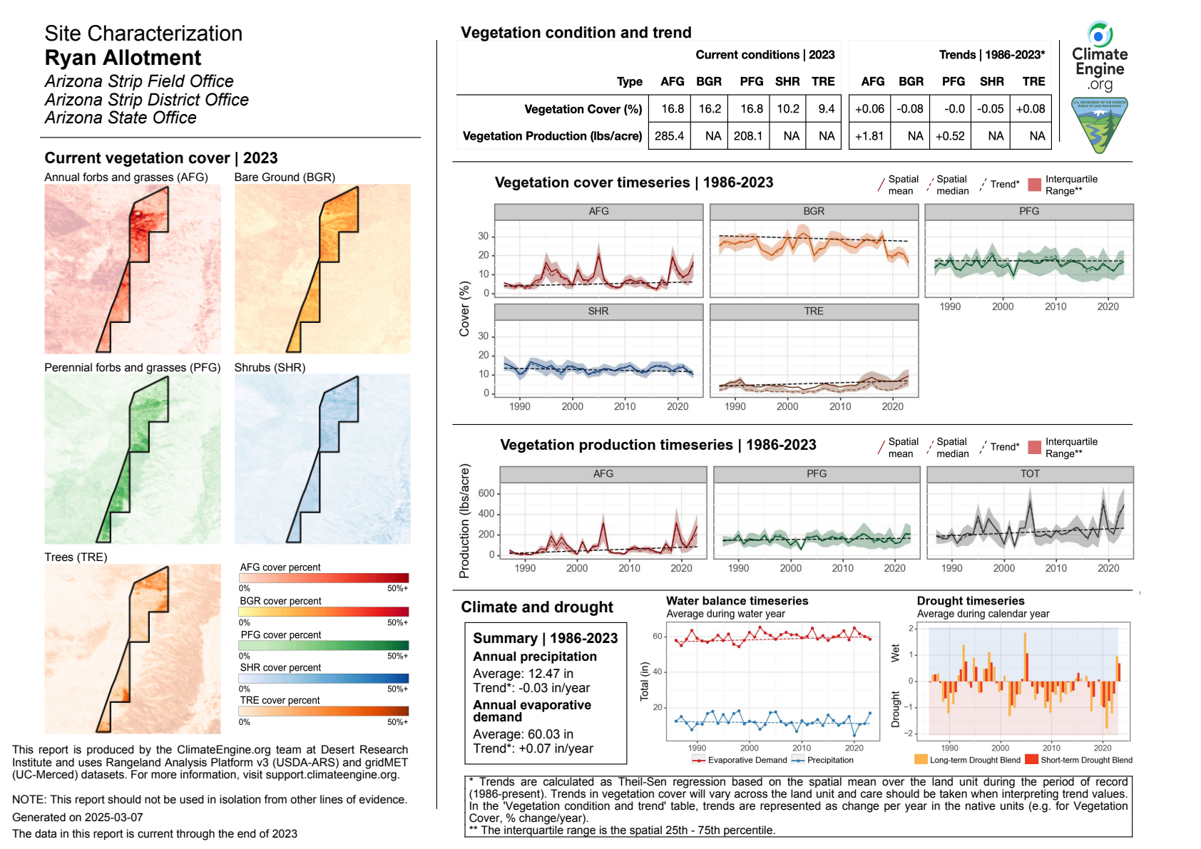
The Site Characterization Reports provide maps, tables, and timeseries of fractional vegetation cover, vegetation production, and drought and climate with data pulled from the Rangeland Analysis Platform, gridMET, and gridMET Drought.
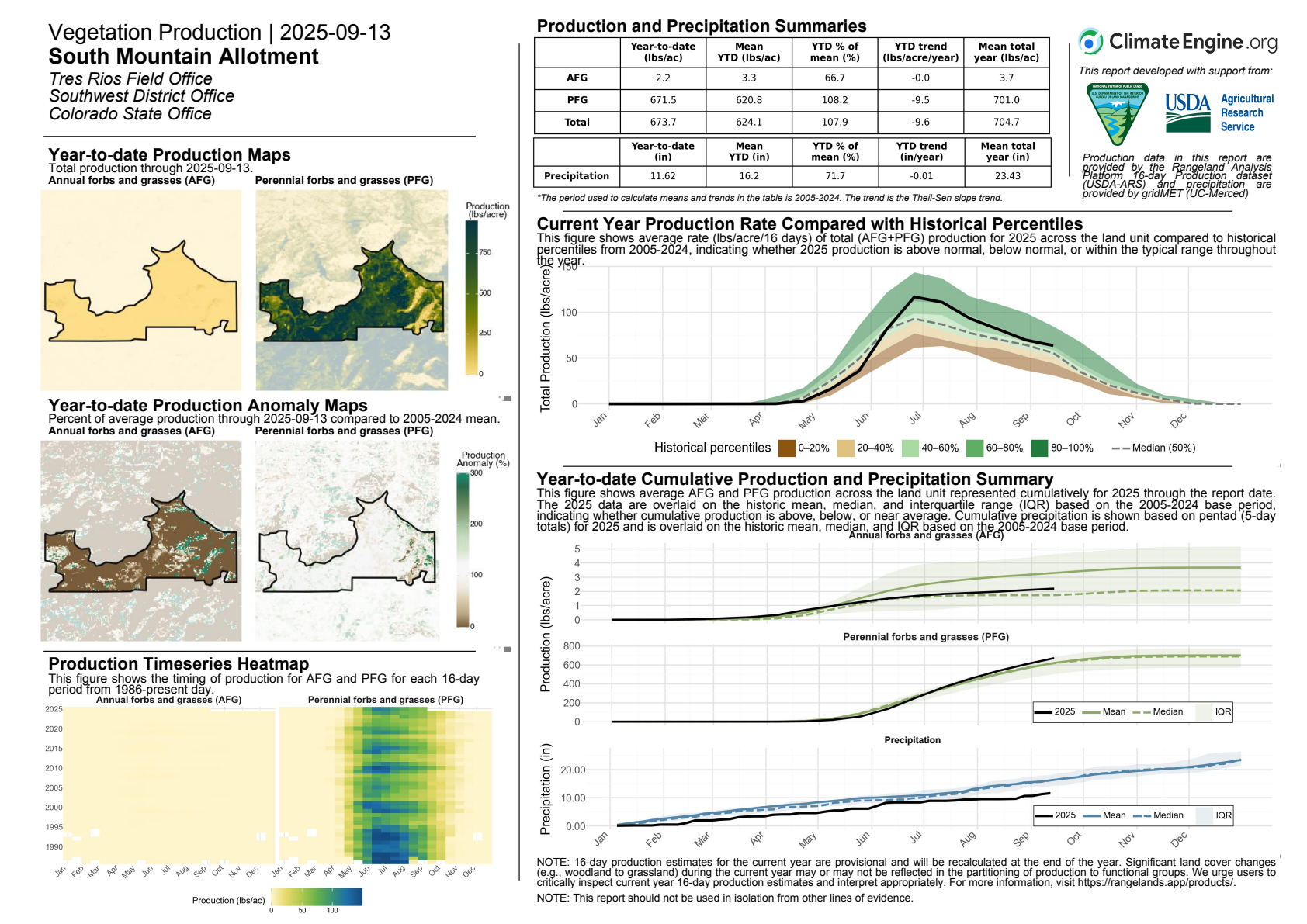
The Vegetation Production Reports provide maps, tables, and timeseries of vegetation productivity with data pulled from the Rangeland Analysis Platform and gridMET.