Normalized Difference Chlorophyll Index
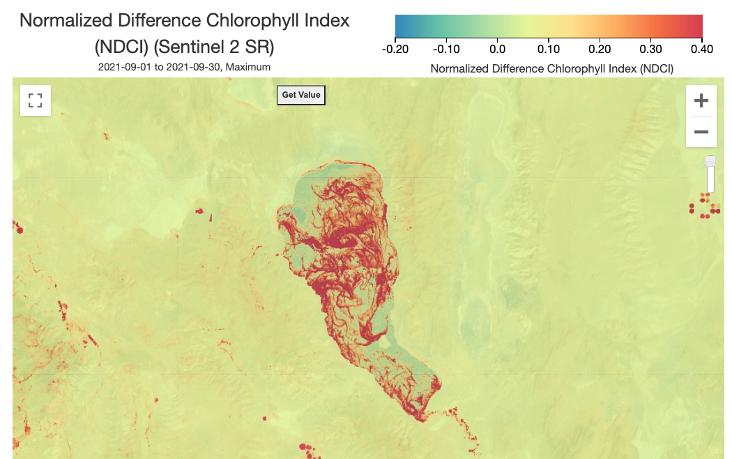 Example map of an algae bloom at Pyramid Lake, NV, USA during September 2021 using NDCI from Sentinel-2 SR
Description
The Normalized Difference Chlorophyll Index (NDCI) was originally proposed for use to predict chlorophyll-a concentration using satellite remote sensing data in estuarine and coastal turbid productive waters and has since been applied for inland freshwater lake assessments.
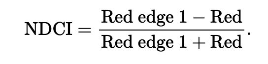
It is calculated using red and red-edge spectral bands, which are both available through Sentinel-2.
References
Mishra, S., & Mishra, D. R. (2012). Normalized difference chlorophyll index: A novel model for remote estimation of chlorophyll-a concentration in turbid productive waters. Remote Sensing of Environment , 117 , 394-406.