VIIRS - 1km - Daily
Description
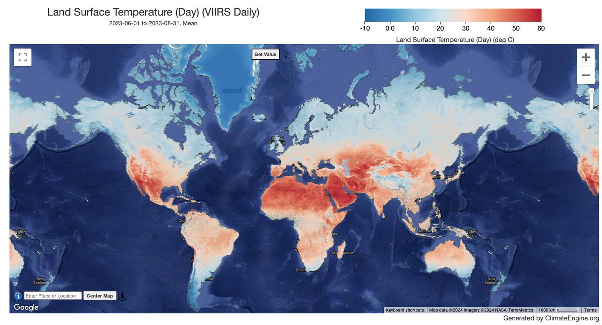
The NASA Suomi National Polar-Orbiting Partnership (Suomi NPP) Visible Infrared Imaging Radiometer Suite (VIIRS) Land Surface Temperature and Emissivity (LST&E) Day Version 1 product (VNP21A1D) is compiled daily from daytime Level 2 Gridded (L2G) intermediate products. The L2G process maps the daily VNP21 swath granules onto a sinusoidal MODIS grid and stores all observations overlapping a gridded cell for a given day. The VNP21A1 algorithm sorts through all these observations for each cell and estimates the final LST value as an average from all cloud-free observations that have good LST accuracies. Only observations having observation coverage more than a certain threshold (15%) are considered for this averaging.
Climate Engine details
- Dataset type
- Remote Sensing
- Climate Engine ID
- VIIRS_DAILY
- Documentation
- https://support.climateengine.org/article/147-viirs-daily-land-surface-temperature
Dataset details
- Scale
- 1km
- Frequency
- Daily
- Coverage
- Global
- Start year
- 2012
- End year
- Present
Earth Engine collection details
- Earth Engine asset
- NASA/VIIRS/002/VNP21A1D
- Earth Engine asset URL
- https://developers.google.com/earth-engine/datasets/catalog/NASA_VIIRS_002_VNP21A1D
- Earth Engine source catalog
- Earth Engine Catalog
Variables
API variable docs: #viirs-day-land-surface-temperature-and-emissivity-daily
| Name | Units |
|---|---|
| Land Surface Temperature (Day) | N/A |
References
- None
Website: https://lpdaac.usgs.gov/products/vnp21a1dv002/
Terms of use
All data products distributed by NASA's Land Processes Distributed Active Archive Center (LP DAAC) are available at no charge.